AIS Display
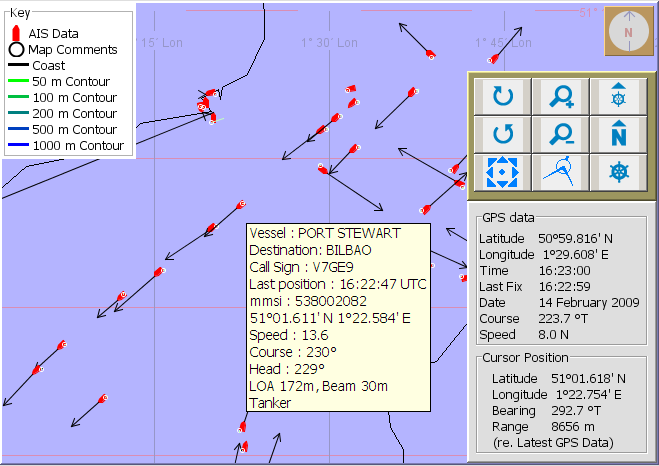
AIS Data can be displayed on the PAMGuard map. Vessels are displayed along with an optional heading arrow. Hovering the mouse over a vessel will bring up a window displaying further information about the vessel.

Options
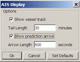
AIS Display heading arrows and the track of each vessel can be turned on and off from the AIS Display dialog which is accesed from the Display>AIS Ship Reporting>Display Options menu command.

A full list of recent AIS data can be viewed from the Display>AIS Ship Reporting>Show all Ship Data. Note that so called “static” data, such as the vessel name, type, cargo and destination are transmitted less often than position course and speed information. It is therefore not unusual to see AIS data items which only have basic position information. Cargo and Destination information accuracy is also highly dependent on each vessels master keeping that information up to date.