Map Information Display Panel
Overview
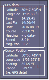
The map information display panel provides the user with geographical position and range information. The figure below gives an example of the display.

GPS data
Here, the latitude, longitude, time, date, true course and speed as derived from the ship’s GPS are displayed.
The information area can be displayed or hidden using the map pop-up menu.
Cursor Position
The cursor position in latitude and longitude is displayed, by converting screen coordinates to real-world coordinates.
The range and bearing from the ship’s GPS to the cursor is also shown here. This will allow range estimates, for example, between the ship and areas where bearing lines cross.
Other Measurements
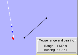
To measure between two arbitrary points on the map, press the ‘Measure With Mouse’ button on the map control panel and drag the cursor across the screen. An additional display panel will appear above the controls showing the range and bearing from where the mouse was pressed down to where it has been dragged to.
